Rozita Zare, Mahmoud Fathi, Mohsen Javanmiri Pour, Sasan Babaei
Forestry, Islamic Azad University- Science and Research Branch, Tehran, Iran
Forestry and Forest Economics Department, Natural Resource Faculty, University of Tehran, Iran
Member of Scientific Board of Forestry Department; Islamic Azad University; Science and Research Branch, Iran
Key words: Multi-criteria decision method, forest development, Vesyeh watershed, AHP, GIS, ecological, plant species.
 Abstract
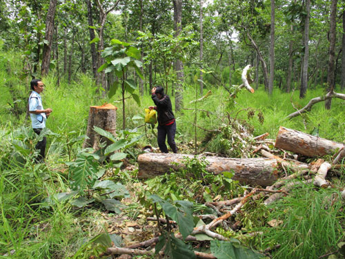
According to natural forests deterioration along with human population increase and need to forest services, forest development, and afforestation is of inevitable importance. For this purpose, the present study aims to determine suitable area using multimedia evaluation. Effective environmental criteria were determined in evaluation of area potential with regard to study purposes. In this regard, there counted variable purposes for the present study, including: physiographic, temperature, precipitation, land, soil (depth, texture, and drainage), hydrology and land use planning. Using GIS, required information were overlaid to produce isotope environmental unit. Determined limit was identified by Boolean logic using AHP. Qualitative index and total value were computed using 2-polar comparison and SAW, respectively. Results showed that 1378 ha of 2516 ha lands profited of more suitable for forest development, of which 374 ha, 424 ha, 285 ha and 295 ha had shown more suitable, suitable, weak and very weak situation for forest development. Totally, 798 ha were presented as appropriate land. In addition, paying attention to ecologic units, existence of non-indigenous and indigenous species adapted to area and ecologic needs, following species were suggested: JuniperusPolycarpos, Amygdalusscoparia, Celtiscaucasica, Elaeagnusangustifolia, Berberiscrataegina, Pinuseldarica, Amygdaluslycioides, Morusalba.
Get the original articles in Source: Volume 4, Number 2, February 2014 – JBES
Journal Name: Journal of Biodiversity and Environmental Sciences (JBES)
Published By: International Network for Natural Sciences
Related Post: The measurement of heavy metal (lead) concentration in muscle tissues of Brachirusorientalis in Bushehr and Asalouyeh seaports, Persian Gulf, Iran – JBES
 Parviz Khosravi, Amirhossein Halabian, Mohsen Heydari, Hosseinali Khammary